Rainy Lake Fishing Map
Rainy Lake Fishing Maps – Be sure to bring your maps when you come visit!
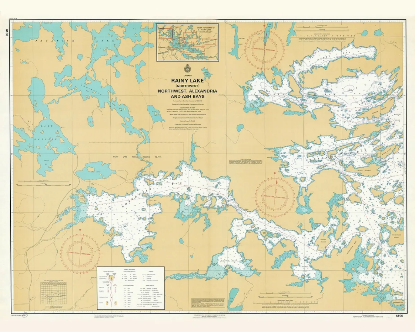
Rainy Lake Nautical Charts

Scale: 25,000
Actual Chart Size: 30.9″ x 42.4″
Paper Size: 36.0″ x 46.0″
Edition Date: 1991-06-21
Last Notice: 20000929
The chart you are viewing is a Canadian chart by OceanGrafix. This chart is available for purchase online.
Navionics Web APP
Our Navionics Web API allows Camp Narrows guests and Rainy Lake visitors to see the terrain and contours of Rainy Lake. This mapping feature includes SonarCharts™ HD bathymetry, which is a map featuring extraordinary bottom contour detail, great for increasing awareness of shallow waters and for locating fishing areas at any depth level. Integration with third party maps such as Bing (Google with limited features), enables you to add points or draw lines and polygons for a richer user experience
PACKAGES & RATES
CLEAN & UPDATED CABINS
CAMP INFO
Book Your Next Canadian Vacation.
Experience an Incredible Outdoor Vacation Experience at Camp Narrows

